Drone Mapping Software for Smarter Farm Decisions
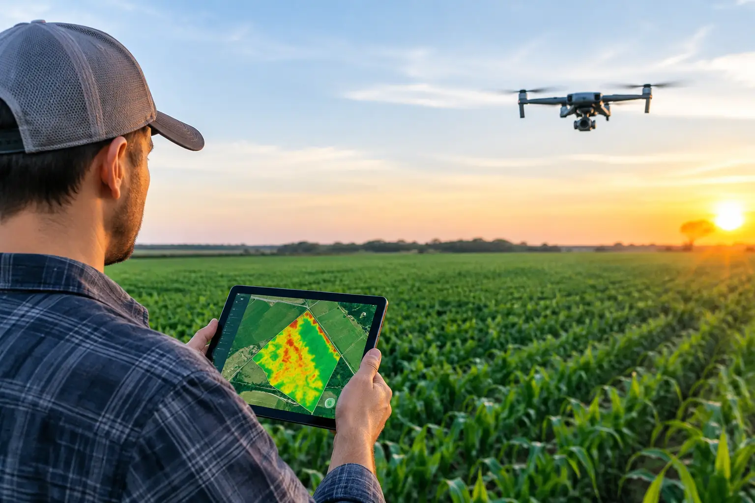
A drone flight can show a field in minutes. The real commercial value comes after landing, when drone mapping software converts hundreds of images into maps that help growers, agronomists, and farm managers decide where to scout, irrigate, repair, spray, or invest.
For agricultural businesses, the question is not simply whether a platform produces an attractive aerial image. It is whether it turns flight data into reliable information that reduces wasted passes, identifies risk earlier, and supports decisions across thousands of acres or multiple farm locations.
What Drone Mapping Software Does on a Farm
Drone mapping software processes overlapping photographs, thermal captures, or multispectral imagery collected during a flight. It uses image matching and georeferencing to create an accurate representation of the field. Depending on the platform and sensor, that output may include an orthomosaic map, plant-health index, elevation model, stand count, or volumetric measurement.
An orthomosaic is more than a stitched image. It is corrected so users can measure real distances and areas directly on the map. That makes it useful for documenting drainage issues, checking irrigation coverage, measuring damaged acreage, and comparing field conditions over time.
Multispectral workflows add another layer. They record wavelengths beyond normal visible light, helping agronomists spot variation that may not be clear from ground level. A low vegetation index does not diagnose a crop problem by itself. It can, however, direct a scout to the right rows before a small issue becomes a costly one.
Common agricultural outputs
The most useful outputs depend on the crop, terrain, and operation. Commercial farms commonly use drone mapping platforms for:
- High-resolution field and orthomosaic maps for documentation and measurement
- NDVI or similar vegetation-index maps for targeted crop scouting
- Digital surface and elevation models for drainage, grading, and water-flow planning
- Plant counts and stand assessments for emergence checks and replant decisions
- Stockpile, compost, silage, or earthwork volume calculations
- Prescription-zone planning when imagery is combined with agronomic and equipment data
Why Mapping Software Matters More Than the Drone Alone
A capable aircraft and camera matter, but the software determines how usable the captured data becomes. A low-cost drone can produce sharp images that look persuasive yet fail to align accurately enough for measurement. At the other end of the market, a sophisticated processing platform may offer more analysis than a small operation needs.
The right choice depends on the decision being supported. A vegetable grower monitoring irrigation uniformity may prioritize frequent, fast map delivery. A drainage contractor may need highly accurate elevation outputs. A seed company running trial plots may value repeatable flight plans and plot-level comparison tools more than 3D visualization.
This distinction is particularly relevant for service providers. If a business sells maps, crop reports, or survey support to clients, it needs consistent processing, straightforward exports, clear reporting, and a workflow that does not create bottlenecks during the growing season.
Types of Drone Mapping Software for Agriculture
Not every platform is built for the same job. The table below highlights the main categories buyers will encounter.
| Software type | Best agricultural use | Key advantage | Main trade-off | |—|—|—|—| | Cloud photogrammetry platform | Field maps, scouting, acreage measurement | Fast processing and team access from any location | Subscription costs and internet dependence | | Desktop photogrammetry software | Detailed processing and large image sets | More control over settings and local data storage | Requires stronger computers and trained operators | | Farm scouting platform | Crop monitoring and field issue reporting | Simple dashboards for agronomists and growers | May offer less survey-grade measurement capability | | Survey and construction mapping software | Drainage, grading, topography, stockpile volumes | Higher-precision tools and professional exports | Often more complex and costly | | Drone fleet management platform | Multi-farm or service-provider operations | Organizes flights, teams, compliance, and records | May require separate software for advanced mapping |
Many farms use more than one system. For example, a crop consultant may process imagery in a mapping application, share observations through a farm-management platform, and send shape files to equipment or irrigation partners. Integration matters because aerial imagery has limited value if it remains isolated from field records and operational action.
Features to Compare Before Buying Drone Mapping Software
Image accuracy and measurement tools
Ask how the platform handles georeferencing, ground control points, and real-time kinematic or post-processed kinematic positioning. For basic scouting, GPS-level positioning may be sufficient. For drainage design, boundary measurement, or construction work, higher accuracy is often worth the added equipment and setup time.
Also confirm which measurements can be made directly in the software. Area, distance, elevation, slope, and volume tools are not equally developed across platforms. If reports will be shared with landowners, buyers, insurers, or contractors, measurement confidence becomes a commercial requirement.
Sensor and data compatibility
Some systems are designed primarily for standard RGB images. Others accept multispectral, thermal, LiDAR, or satellite data. Do not pay for compatibility that the operation will not use, but avoid buying a closed system if future plans include crop-health analysis or terrain work.
For row crops and orchards, multispectral support can be valuable. For livestock operations, RGB mapping may be enough for fencing, water-point checks, manure management documentation, and facility planning. Thermal imagery has specialized uses, including irrigation troubleshooting and livestock observation, but its value depends heavily on flight timing and interpretation skills.
Analytics that support action
A map is only useful when someone knows what to do next. Look for software that makes it easy to compare dates, mark areas of concern, create zones, and export data to advisers or equipment systems. Automatic plant counts, weed detection, and crop classification can save time, but these tools should be validated against ground observations before they drive costly treatment decisions.
The most practical platforms let teams move from map to task. That could mean assigning a scout, exporting a field boundary, calculating a damaged area, or sharing a concise client report without forcing recipients to learn complex mapping tools.
Pricing, storage, and user access
Software costs may be charged per month, per user, per acre, per processing credit, or per project. A low entry price can become expensive when image volumes rise during peak season. Businesses should check storage limits, export restrictions, processing turnaround time, and fees for additional users before committing.
For exporters, consultants, and agricultural service companies, client access is another consideration. Branded reports, controlled sharing permissions, and organized project folders can make the difference between a useful internal tool and a service that supports repeat business.
A Practical Farm Workflow From Flight to Field Action
The strongest drone program starts with a defined question. “We want aerial imagery” is too broad. “We need to identify ponding zones after a heavy rainfall” gives the flight and processing work a clear purpose.
First, set flight parameters for the crop and required output. Altitude, overlap, speed, lighting, and sensor choice affect map quality. Consistent flight plans make seasonal comparisons more meaningful, especially for trial plots, orchards, and irrigated fields.
Next, process the images and review the map alongside farm records. Compare unusual zones with soil type, irrigation layout, yield history, planting records, and recent weather. A stressed area can result from compaction, pests, nutrient imbalance, water issues, or simple image artifacts. Ground truthing remains essential.
Then assign a specific action. Scout the zone, inspect an irrigation line, take tissue or soil samples, repair a drainage outlet, or confirm stand loss. Record what was found so the next flight improves the operation’s knowledge rather than becoming another disconnected image file.
Finally, retain the map as evidence. Seasonal records can support contractor discussions, farm planning, crop insurance documentation where appropriate, landowner communication, and internal performance reviews. They also help service providers demonstrate the value of their work to customers.
Where Drone Mapping Delivers the Strongest Return
Drone mapping generally produces the clearest return where a timely view changes a decision. Large or fragmented operations benefit because walking every acre is impractical. High-value crops benefit because early detection can protect yield and quality. Farms with uneven terrain, drainage challenges, variable irrigation, or frequent storm damage also have clear use cases.
It is less compelling when the team lacks someone who can interpret maps or act on findings. A platform cannot replace agronomic judgment. It can make that judgment faster, better targeted, and easier to document.
For agricultural businesses comparing drone operators, mapping consultants, sensors, and software providers, a marketplace-first approach saves time. Agricial helps professionals identify specialized agricultural service partners and compare the capabilities that match their crop, geography, and commercial goals.
The best first step is a focused pilot on one field and one decision. Choose a recurring problem, establish a repeatable flight plan, and measure whether the map leads to a faster or better action. When it does, drone mapping becomes more than a technology purchase – it becomes a practical part of farm management.